


ALMA 1 Voting District, Marion County, Illinois
About
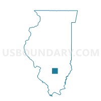
Outline

Summary
| Unique Area Identifier | 573458 |
| Name | ALMA 1 Voting District |
| County | Marion County |
| State | Illinois |
| Area (square miles) | 35.03 |
| Land Area (square miles) | 34.96 |
| Water Area (square miles) | 0.07 |
| % of Land Area | 99.80 |
| % of Water Area | 0.20 |
| Latitude of the Internal Point | 38.68971140 |
| Longtitude of the Internal Point | -88.85518670 |
Maps


Graphs
Select a template below for downloading or customizing gragh for ALMA 1 Voting District, Marion County, Illinois


Neighbors
Neighoring Voting District (by Name) Neighboring Voting District on the Map
- ALMA 2 Voting District, Marion County, IL
- KINMUNDY 1 Voting District, Marion County, IL
- KINMUNDY 2 Voting District, Marion County, IL
- MEACHAM Voting District, Marion County, IL
- OMEGA Voting District, Marion County, IL
- SALEM 6 Voting District, Marion County, IL
- STEVENSON Voting District, Marion County, IL
- TONTI Voting District, Marion County, IL
Top 10 Neighboring County Subdivision (by Population) Neighboring County Subdivision on the Map
- Salem township, Marion County, IL (9,286)
- Stevenson township, Marion County, IL (1,301)
- Kinmundy township, Marion County, IL (1,186)
- Tonti township, Marion County, IL (1,013)
- Alma township, Marion County, IL (836)
- Omega township, Marion County, IL (501)
- Meacham township, Marion County, IL (375)